Queenstown and Milford Sound.

Queenstown is known as “the adventure capital of New Zealand,” though I’m not sure exactly why because they have the same adventure options as like 3 other places in New Zealand. The only thing I was considering doing was bungy jumping, but by the time I decided to spend the money, it was fully booked for the time I would be in town. Other than adventure sports, Queenstown is a big party town. Lots of bars and lots of drink specials!! I was in town for 2 nights and had to get up early for bus trips both days, so I drank a total of 6 beers, which was actually 1 more drink than I’d had my entire time in new Zealand to that point.

I didn’t arrive in Queenstown until just before sunset and after checking in to the hostel, I went down to the lake, found somewhere to eat and wandered around town.

After exploring for a while, I drank those 6 beers and called it a night. The next morning, I was up early to catch the bus for my day trip to Milford Sound. If we could have driven across the Southern Alps, it would have taken about 30 minutes to get to Milford Sound. You have to go down and around the mountains to get there though, so it took 4 1/2 hours. Along the way we stopped at the Mirror Lakes.

I won’t say much about Milford Sound because the pictures say plenty. Milford is actually a fjord, not a sound. It stretches 15 km inland from the Tasman Sea. Mitre Peak rises up over a mile from the waters. They get over 250 inches of rain during the year (though I got a beautiful day) and the rains create hundreds of temporary waterfalls throughout the sound. It is the most famous tourist location in New Zealand and was once called the “Eighth Wonder of the World” by Rudyard Kipling. I spent 9 hours on a bus for a 2 hour ferry ride through the sound and it was worth it.

20170418_122609

Mitre Peak is the tallest of the two mountains in the center.

20170418_125407

Waterfall rainbow!

20170418_130422

20170418_134527_001

I’ll chase waterfalls all day long, even if TLC tells me not to.

20170418_135329

20170418_140140

20170418_141057

Get out of my shot before I discount double check you over the railing, Aaron Rodgers!!

So yea, I took a lot of pictures at Milford Sound. Milford Sound is a must see if you’re ever in New Zealand!!! Back on the bus for the 4 1/2 hour trip back to Queenstown, but still managed to catch another beautiful sunset.

We got back around 7 and I headed out for dinner and after dinner I stopped at the candy store. I am addicted to Starburst Snakes. They are just gummy snakes, but I can’t get enough of them. On the way out, I tried a couple pieces of fudge. On of them was called “farts.” I wasn’t going to not try fart fudge. It was kinda sour with mini M & M’s on top and it was delicious!! The next morning I was off to my next stop, Lake Tekapo.

*Though I still have a couple New Zealand posts to write, today marks the end of my time in New Zealand. I am sad to leave. Even though the weather didn’t always cooperate, New Zealand is so incredibly beautiful. I’m flying from Christchurch back to Sydney today and tomorrow I begin my 20 day tour up the East Coast to Cairns. The main attraction on the upcoming tour is a 3 day, 2 night Whitsundays cruise and snorkeling the Great Barrier Reef!! I’m also hoping to get on a surfboard.

I’m in love!!!

On the bus ride from Punakaiki to Wanaka we stopped to see Thunder Creek Falls and Lake Hawea.

20170415_134637

Lake Hawea was beautiful, but just around the corner was Lake Wanaka and it was love at first sight!!! If I were to ever move to this side of the world, it would be to Wanaka.

Water sports, hiking, mountain climbing, skydiving in spring, summer and fall and skiing in the winter. I want to pick Wanaka up and drop it between Cape Cod and Boston and retire there.

I spent sunset down by the lake before heading back to the hostel to rest up for my morning hike.

I got up early the next morning to watch the Bruins shit themselves in the 3rd period of game 2. I headed out at 10:30 to go for my hike to the top of Roy’s Peak. The receptionist at the hostel told me it would take about 45 minutes to walk to the carpark where the track started. It ended up being 6 km and taking an hour and a half. I stopped for a few minutes to take pictures at the Rippon Vineyard on the lake and also spent some time with a couple relatives I met along the way.

It was noon by the time I got to the start of the summit trail and the hike was supposed to take 5-6 hrs. Plus I was going to have to walk about an hr and a half back to town. Time was going to be a factor unless I wanted to walk back to town in the dark. I got maybe 2/3 of the way up the mountain and decided it was time to turn back. I still go some great views, but there’s always a different feeling at the top.

I mentioned skydiving earlier. Well, I got up close and personal with some skydivers on my hike. I only got a picture of a guy in the 2nd grouping, but the first guy to go past me was about 2 feet off the ground and 10 feet away from me. I was facing the lake taking pictures when he flew on by and I was quite surprised by him dropping in on me.

Most of the Roys Peak track is on private farmland. There are about 4.5 million people in New Zealand and about 33 million sheep. This is the only picture of sheep I have taken the entire time I’ve been here.

20170416_134403

I got back to town just before sunset and found a burger joint to go to for dinner. I ordered cajun fries and while eating them I did something that I am not proud of…….I dipped them in the homemade aoili that came with them. I’ve been trying to justify my actions by saying there was just so much cajun seasoning on them that I needed something to cut into the powdery texture. While this may be true, it does not excuse my sickening actions. What kind of monster have I become? There’s a fine line between dipping fries in mayo and becoming a serial killer. I can only hope it’s not too late for me to turn back. 20170416_154916

Fall has arrived in New Zealand and this seems like a beautiful spot to hide the bodies.

Wekas and dolphins and stingrays….Oh my!! (We’re not in Kansas anymore)

The next stop on my trip was Nelson, which I had never really planned on going to, but it seemed to be the closest I could get to Abel Tasman National Park by coach. I checked into The Prince Albert Bar and Backpackers, which ended up being the nicest hostel I’ve stayed in my entire trip so far.

The bar had an awesome patio with strands of their own hops growing overhead and the hostel had a nice, big courtyard with hammocks.

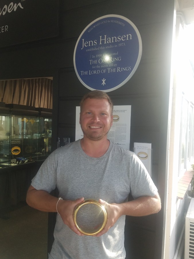
When I got settled, I found out that one of the jewelers in town, Jens Hansen, was where the rings for The Lord of the Rings movies were crafted. I rushed over and got there about 30 minutes before close. When one of the sales associates asked if I needed any help, I said, “I’m not going to pretend I can afford anything in here. I just came to see the rings.” There was “one ring to rule them all,” but they made 40 of them for the movies. They were all sized and weighted differently for certain scenes. I got to hold the big ring that they used in the opening credits of the movies.

20170410_162400

After the jewelery store, I walked around town and saw Winston’s Church Hill.

Oh, yea, I’m kidding. It’s just called Church Hill.

The next day, I was up early to catch a sea shuttle to Abel Tasman National Park. The park’s coastline is only accessible by boat as there are no roads in and out. Abel Tasman is the smallest national park in all of New Zealand.

The 2 1/2 hour ferry ride took me as far up the coastline as boats are permitted to sail before turning back and dropping me at Medland Beach. Along the way we cruised past Split Apple Rock and then Adele Island to see the colony of New Zealand fur seals.

Interesting story about these dying pine trees…..

20170411_101804

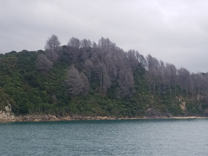
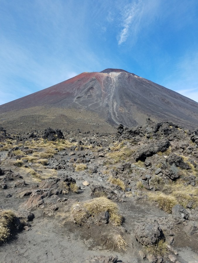
Pine trees aren’t native to New Zealand. About 100 years ago, the smart guys over at Harvard decided to bring them over here to see how they’d fair. Well, they do really, really, really well. So well that forestry is one of the biggest industries in New Zealand. Problem is they don’t really want them invading the national parks, so the pines in this picture are being intentionally poisoned. The ones near walking tracks or easily accessible areas are cut down. Ones like these that are harder to get to…..they shoot them from a helicopter with poison bullets. How cool is that?

“What do you do for a living?”

“I fly around in a helicopter and shoot trees with poison bullets.”

Where did I go wrong in life? (Rhetorical question)

The walk from Medland Beach to Anchorage Beach was 11.3 km and took about 3 1/2 hours. The trail was mostly through the forest, but popped out on a few beaches too. During the walk I saw a weka, which is a flightless bird, not that unlike a kiwi and it had me fooled for a bit. I had hoped it was a type of kiwi that I wasn’t familiar with since there are 5 different species.

20170411_142453

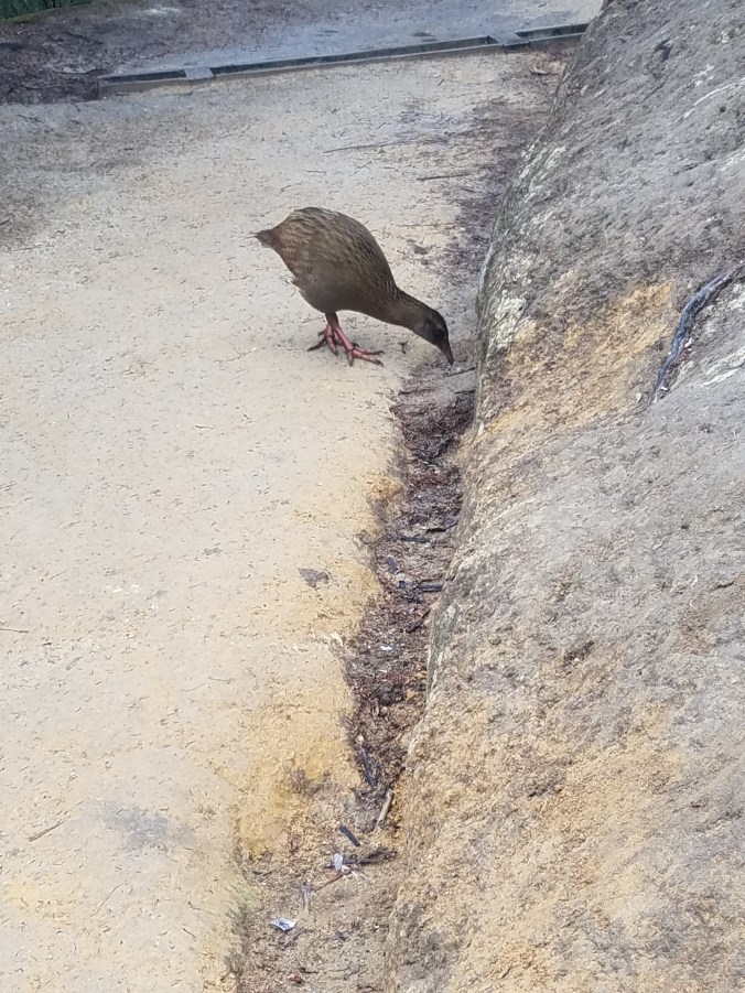
Weka (definitely not a kiwi)

When I got to Anchorage Beach, I had about 45 minutes to kill before the boat arrived. A stingray occupied 15-20 minutes of that time. I wasn’t sure if I should go play with it or avenge Steve Irwin. They are pretty gentle for the most part, but if they get startled or feel threatened, they may attack. The barbs on their stinger inject a poison that can cause paralysis and death in humans. The stinger itself can also kill you if it hits you in the right spot (RIP Crocodile Hunter).

images

Crikey, she’s a big girl!!! It got pretty close to shore, but when I got in the water, it swam further out to go around me.

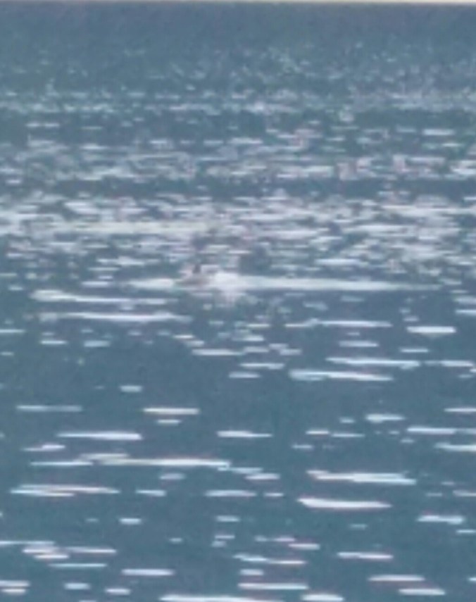
The boat eventually came and we headed back, but on the ride back we saw a dolphin!! They are usually around earlier in the year and the guide said it had been about 2 months since they had seen one, so we got lucky. It didn’t surface much and it was hard to get a picture, but I managed to get one of it’s fin above water.

20170412_080406

The next day I took the bus from Nelson to Punakaiki. I got dropped off at the wrong bus stop and had to walk 2 miles to the hostel with all my stuff (between my backpack and my daypack, that’s about 55 lbs strapped to my back). By the time I got to the hostel, I was soaked in sweat and rain. I checked in, got settled, showered and rested a bit.

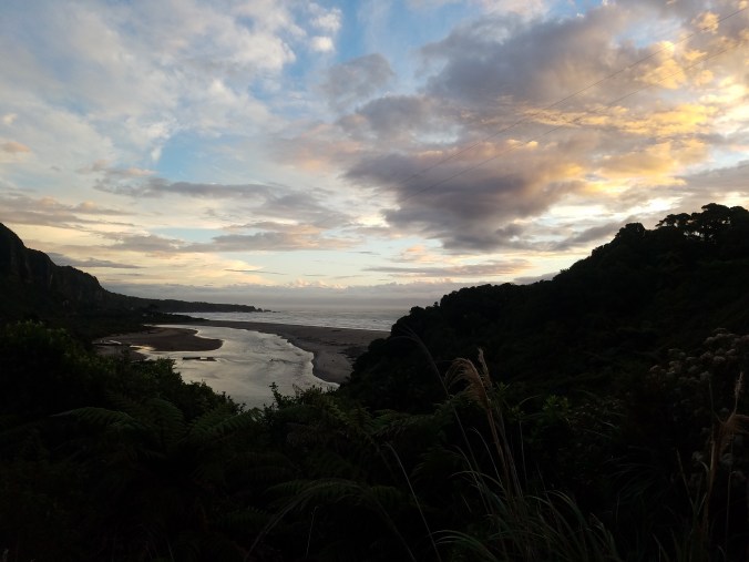
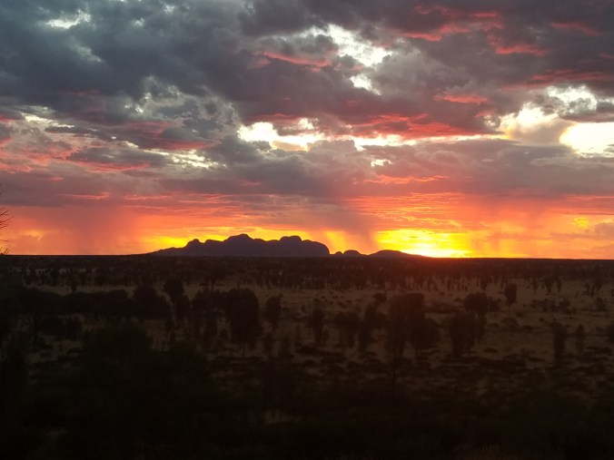
A little before sunset, I headed almost all the way back to where I had been dropped off to go see the Pancake Rocks and Blowholes. By the time I got there, it was almost dark and I couldn’t really see much. I got a few nice sunset pictures during the walk though.

20170412_180201

The walk back to the hostel was pitch black except for the flashlight on my phone. There were no street lights, only a couple cars that passed and then it started to pour about 15 minutes before I got back.

The next day, Lisa (a German girl from my room) and I got dropped off at the Pancake Rocks Information Center at about 11 am. Our bus wasn’t until 12:35, so we dropped our backpacks and walked the loop path to the Pancake Rocks.

20170413_113429

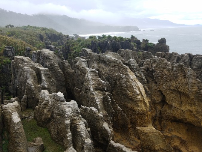
These aren’t the pancakes I was looking for.

The whole walk took less than an hour, so we grabbed some lunch at the cafe, which killed the rest of the time until the bus arrived.

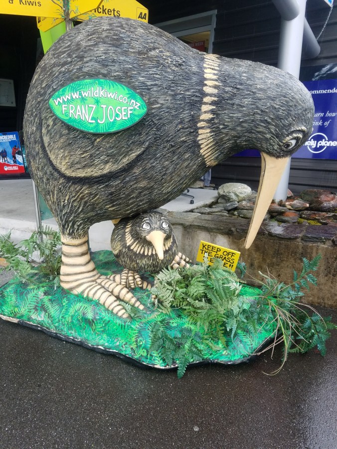
I got to Franz Josef around 5 pm and checked into the hostel. It was raining, but I explored the small town before heading back to the hostel for the night.

20170414_120439

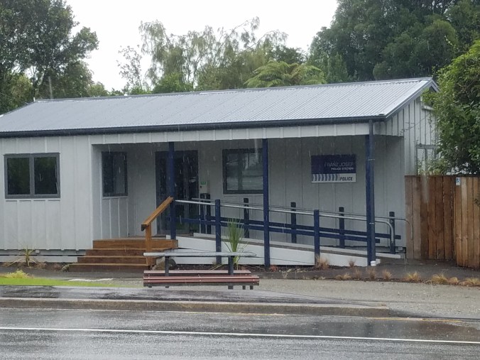
The Franz Josef Police Station is adorable.

The hostel has a DVD collection and a nice, big flatscreen TV, but everyone was watching The Lord of the Rings. I think it’s mandatory in New Zealand. I’m not kidding. I wrote that in my journal and then 30 minutes later, these 2 German girls (there are so many Germans) that checked into my room today asked if I minded if they watched a movie with the sound on. I said no problem and asked if they were watching anything good. I should have already known the answer. They are watching it in German. I’ve managed to avoid watching it even though I’ve seen it on at most of the hostels I’ve been to here. Thank god for streaming movie websites.

I got up this morning and tried to beat the rain to the Franz Josef Glacier. It was an hour walk to the carpark and then a 1 1/2 hour roundtrip walk to the glacier viewing platform.

I got some good pictures on the walk and managed to beat the heavier rain there, but not back. More importantly, I beat the clouds that crept in and covered the mountain tops just after I headed back from the glacier.

At the glacier platform, I ignored the ropes, warning signs and article about 2 dead hikers to try and get closer to the glacier. On Fox Glacier, you are required to have a guide, but not on Franz Josef. Unfortunately, I ended up turning back before I got to the glacier when I was faced with about a 20 ft drop down a 70° slope. I only had my sneakers on, so footing became an issue. I was also worried about the possibility of flash flooding due to the weather the past few days and the forecast for today.

I spent the rest of the day writing, doing laundry, packing and staying dry. Tomorrow morning I’m off to Wanaka for 2 days and then Queenstown, “the adventure capitol of New Zealand” for 2 days.

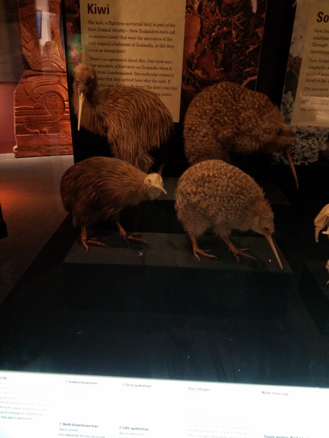
This is as close as I’ve gotten to kiwis so far….

20170414_121439

Time for some island hopping! Wellington to Picton

My last stop on the North Island was New Zealand’s capitol city of Wellington. How much of a city can you really see in a day and a half? Not much. I got into the city late in the afternoon and did some grocery shopping and wandered around a bit, but it was still raining so mostly I stayed in the hostel.

I woke up the next morning and saw this strange site out the window. It was the sky….it had turned blue overnight and there was this giant, glowing orb floating in the middle. What kind of sorceror has such powers?

Time to take advantage of the weather and cram as much as I can into a day. I headed off to the Botanical Gardens. I don’t know if it’s the landscaper in me that heads to the gardens first or if it’s because they are free. I’d like to think work has nothing to do with it. Speaking of work, those poor assholes are back at it. See you in July, fellas!!!

In the gardens, there was a “Sundial of Human Involvement.” The sundial uses a person’s shadow to tell the time of day. The sign said the hour indicators were moved twice a year to account for daylight savings, but the sundial was off an hour so……..

There was also a “tree house” in the gardens and inside was a history of New Zealand’s dinosaurs and some fossils. It was really random.

After the gardens, I walked to Parliament House. I had other stuff to do so I just buzzed by for pictures and I didn’t go inside for the tour. The “Beehive” houses the Executive Wing of the New Zealand government, including the Prime Minister’s office.

20170407_110631

The Beehive

From Parliament, I ran a couple errands, grabbed some lunch and then headed to the Museum of New Zealand Te Papa Tongarewa. I saw my first kiwis at the museum. They were dead and stuffed, but it still counts. They’re a lot bigger than I thought they were.

20170407_142845

I also saw one of the aliens from the movie Independence Day. Apparently, the New Zealand government is trying to pass it off as a giant squid, but I know the truth.

20170407_142356

According to the sign, this is the only actual specimen of a giant squid on display in the entire world.

The museum had this awesome exhibit about New Zealand’s involvement at Gallipoli in World War I. Unfortunately, the exhibit was really cramped and crowded and people were moving really slow, so my natural reaction was to fly through it and get the hell out of there.

There was also an earthquake exhibit, which talked about the devastation from a large earthquake. There was a small house set up with a short video and during the video the whole house shook to replicate the effects of a 5.0 aftershock. Little did I know I’d get the real thing a few days later!!

At this point, I got distracted by a couple people messaging me and stopped really paying attention, kinda got lost in the museum and eventually found my way to the exit.

That was enough excitement for one day. I had to get back and do some stuff to get ready to leave for the South Island in the morning.

The next morning I took an Uber to the ferry terminal and boarded for my 3 hour ride from Wellington to Picton. The sun had disappeared again, but at least it wasn’t raining. I got to the hostel around 1, went grocery shopping and spent about 4 hours trying to book and plan my South Island adventure. Planning is not my favorite part. I like to just do stuff, but without a car, travel plans are kind of necessary.

That night as I relaxed on the couch, I felt my first ever earthquake or at least I was pretty sure it was an earthquake. I only felt the couch shake, so the next day I checked the New Zealand earthquake website.

Woohoo!!!! I was right!!! I love being right!!!

The sun made a triumphant return the next day, so I went for a 3 hr hike from Victoria’s Domain to The Snout along the Marlborough Sounds. The walk turned into a 5 hr walk because it took me an hr to walk to the start of the trail from the hostel. It was worth it though!!

20170409_113731.jpg

20170409_113721

Later that day, I walked down to the marina to explore the town some and watch the sunset. The sun set on the other side of the mountains, so…….😝. Oh well, pretty sure nothing is ever going to beat the Kata Tjutu sunset anyway.

20170315_190852

That’s some Lion King shit right there.

Sorry, back to the harbor in Picton.

After sunset, I went back for a relaxing night at the hostel. Late that night, I felt my 2nd earthquake!! I was sitting on a dining room chair for this one and felt it shake the floor and the wall next to me!! I went back to the website to check it out.

Screenshot_20170409-234605

This one was slightly bigger, but also closer to Picton. It turns out that over the course of my 2 days in Picton, there were 23 earthquakes recorded in New Zealand, but only 2 were close enough or big enough for me to feel (that’s what she said).

Today, I was off to Nelson for 2 days. Tomorrow will probably be my only day without a bus ride for the next week or so, maybe until I get to Milford Sound, which is supposed to be way more impressive than Marlborough Sounds. I just hope the weather cooperates for my ferry tour when I get there. We’ve been getting lots of rain from cyclones that have hit Australia and now Vanuatu. As long as I avoid getting trapped in any town longer than I plan because of flooding, I’ll be happy.

When it rains, go hide in caves.

I haven’t seen the sun since I did the crossing on Saturday. New Zealand is currently getting pounded with rain to the point where Didi told me to come to Bali for her birthday and I googled flights to see if I could escape for a week. Problem is they’re really expensive and it’s raining in Bali too.

After Turangi, I spent a night in Waitomo. There is nothing in Waitomo other than the caves. In fact, I think there are more businesses that run cave tours than there are of anything else in the town.

While walking to the hostel from the bus stop, I noticed a general store. The sign said, “Beer, wine, groceries, souvenirs, cafe.” I needed a new pair of headphones, so after I checked into the hostel I asked the receptionist if they might have them there. She said, “Yea, they might.” So, I walked the mile or so back to the store, in the rain. On the way, I decided I’d buy a steak and actually have a nice meal for dinner. I hadn’t even walked through the doors yet and I knew they didn’t have headphones. When I actually entered the store, they had a single shelf of souvenirs and a bookcase of non-perishable foods.

My steak dinner turned into a can of soup and a bag of chips. The nearest actual grocery store was 5-miles away. Back to the hostel, in the rain, I went.

Over the course of the next 20 hrs or so, I used 7 gigs of data streaming Wrestlemania, a couple of movies and the Sox opener. If you ever get to New Zealand and want to see the Waitomo Glowworm Caves, do a day trip from Rotorua or Auckland. You don’t need to see what Waitomo has to offer above ground.

The morning after I got to Waitomo, I had my tour of the 3 main caves. First up was the Waitomo Glowworm Caves. There was no photography allowed in this cave system, but we took a short walk through the caves. When we reached the Cathedral area of the cave, the guide asked if anyone wanted to sing. At this point, I was a bit annoyed with Waitomo and humans in general, so I thought to myself, “I would love to sing, if you’d all just go away.” They stayed and I didn’t sing. This same situation would repeat itself on the 3rd tour.

The best part of the glowworm caves tour was the 10 minute boat ride on the river in total darkness besides the light from the worms.

The next tour was the Ruakuri Cave. This cave also had glowworms, but we were allowed to take pictures this time.

Hard not to be disappointed in the glowworms when postcards look like this…..

lg-photo4

But the glowworms actually look like this….(probably want to click on those pictures, hahaha).

I don’t know how to take pictures in the dark or maybe I need a better camera.

Turns out the postcard pictures are a 30 minute exposure. It was still cool, but not what I was expecting.

spaceball
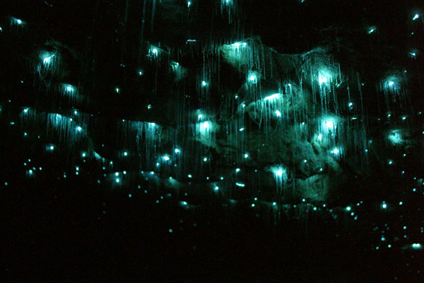
There was a French couple on the tour with their 2 little girls and they were smart enough to let them wear light up shoes to a place where we want total darkness. They did not help my annoyance with people for the day.

We explored more of the cave formations and saw some scallop fossils.

Before the last tour, I had some time to kill so I went on a 30 minute bushwalk near the carpark.

The 3rd cave tour was the Aranui Cave. The cave ceilings were pretty high, but the cave wasn’t very deep so it was a pretty short tour.

The group split up at one point and while we were waiting for the rest of the group, one of the guides was off by himself and started singing, “You are my sunshine.” I need more sunshine in my life. I miss that song. I miss bedtime.

After the last tour, I went back to the hostel and had a little over an hour to kill until I had to catch my bus to New Plymouth. I ended up waiting at the bus stop for an hour and 15 minutes because my bus was late.

I spent 2 nights in New Plymouth and it poured pretty much the whole time. Today I took a 7 hr bus ride to Wellington, where it is still raining, yayyyyyy!!! The rain is finally supposed to stop tomorrow, so hopefully I can actually go do some exploring. I’m only here 2 nights and then I take the ferry over to the South Island.

The South Island is completely different from the North Island, mostly due to the Southern Alps that run pretty much down the middle of the island. Many people say it is much more beautiful than the North Island.

I hope it wasn’t too painfully obvious that I wasn’t really interested in writing this post. I think the weather has had me in a bit of a funk the last 4 or 5 days. I’m workin on it though!

Here are some animals that were at my hostel in Waitomo, because who doesn’t like animals?

Nothing like a 19.4 km hike and a 7,500 ft mountain to put you in your place!!

I got my ass kicked by a mountain yesterday! Not just any old mountain though. This was Mt. Nguaruhoe, better known as Mt. Doom from the Lord of the Rings trilogy. It’s also an active volcano!!

20170401_114413

Mt. Nguaruhoe aka Mt. Doom aka my nemesis.

Tongariro National Park is the oldest National Park in New Zealand. The 19.4 km (12 mile) Tongariro Alpine Crossing hike is the best one-day hike in New Zealand and widely considered one of the top 10 one-day hikes in the world. Along with Mt. Nguaruhoe being used as Mt. Doom, other parts of the National Park were used as Mordor and parts of Middle Earth in the Lord of the Rings movies.

20170401_070828

It begins

There are 3 active volcanoes within the immediate area of the crossing. The first and largest is Mt. Ruapehu.

20170401_072000

Mt. Ruapehu

At 2,797m (9,177 ft) Mt. Ruapehu is the largest volcano in New Zealand and the highest point on the North Island. The volcano last erupted in 2006 and then again in September of 2007. In May of last year, hikers were warned to stay out of a 2 km perimeter around the mountain, due to elevated risk of eruption. In recorded history, major eruptions have occured about every 50 years. In winter, it is the main ski mountain on the North Island. What appears to be snow in the picture are actually glaciers.

The smallest of the 3 volcanoes is Mt. Tongariro, standing 1,978 m (6,490 ft).

20170401_103708

Mt. Tongariro in the background.

Mt. Tongariro last erupted on November 21, 2012. An eruption on August 6, 2012 at the Te Mãri Craters (part of Tongariro) sent blocks as big as 3 feet 3 inches up to 1.2 miles away from the vent. An ash cloud 3.8 miles high travelled 160 miles in 4 hours. In just 39 minutes after eruption, the cloud had expanded to 16 miles long and 9.3 miles wide.

That just leaves me and Frodo’s enemy, Mt. Ngauruhoe. Mt. Doom stands 2,291 meters tall (7,516 ft) and last erupted in 1975. In the 20th century, the volcano erupted 45 times.

20170401_074343

So, I started my hike just after 7 am. All the information I read said to bring plenty of food, water, rain gear, warm weather clothes and all the first aid and safety stuff you may need on a hike, as well as a map and compass. I took everything out of my backpack that wasn’t on the list, but was still carrying an extra 25 lbs on my back. I would have been fine with 3 liters of water, a sandwich, a couple protein bars and my camera in my day pack, but I followed instructions like a good boy.

At the 6km mark, I reached the base of Mt. Ngauruhoe. 7,516 feet up at a 45° slope. Why did I tell everyone I was going to climb Mt. Doom? Oh, well, I had no choice now. Our shuttle bus driver had told us not to climb without a helmet because rocks get dislodged by other climbers and sometimes people get hit in the head by the rocks hurtling down the mountain. I didn’t have a helmet. Most people didn’t have helmets. I only had to dodge one softball sized rock and it only would have hit me in the back of the leg.

Another kid at my hostel had done the crossing also, but started later than me. I passed him as I was just about down the mountain and he was just heading up. When he got back he told me that on his way down, a guy had fallen and had to be helicoptered off the mountain.

I left my pack at the bottom of the mountain, because there was no way I was making it up with it on. Much of the slope we climbed was composed of scree, which is volcanic rubble. Thankfully, there was one narrow strip of pretty solid rock going up a decent portion of the mountain because the scree was essentially like climbing a rocky, sand dune. It took just over an hour and a half to get to the top, but I made it!!!

20170401_103415.jpg

Reppin the champs and bringing the Gronk fiesta to the summit of Mt. Doom!

Going down the mountain was way more fun. It only took about 40 minutes to get down thanks to the scree. I fell on my ass a few times, but I basically jumped, slid, and “skied” my way down.

I left a piece of myself on that mountain yesterday. I’m pretty sure it was my quads. 😂. I had kind of hoped that someone would have stolen my pack or at least lightened my load, but everything was right where I had left it, tucked behind a rock about 10 meters up the summit track. When I got to the bottom, I was greeted by this sign reminding me how far I still had to go.

20170401_115326

😭😔😲😢😴😖🤔😥

I celebrated my successful climb with about 20 minutes of Disney hits before realizing it was gonna take something with a little more energy than “The Circle of Life” to get me through the rest of the hike. The next couple hours of my walk were spent with a Spotify playlist called “Air Punch” and it was amazing.

Screenshot_20170401-115438

The next part of the walk was a nice flat stroll to the South Crater, where Mt. Doom continued to linger over me as though I had not just conquered it.

The leisurely stroll didn’t last long as it was time to ascend 1,886 meters (6,187 ft) to the Red Crater, which is part of Mt. Tongariro. This was a struggle. My legs were gone and my pack felt like it was full of bricks. At one point, I literally looked at my bracelet and thought, “Come on, Bear. Get me through this.” Kylah was my trainer for the Falmouth Road Race last year. She got me to about the half mile point before she gave up, but man did she push me hard for that half mile!! Love you, Peanut!! 😚

20170401_124402

The Red Crater

I got to the top and had a great view overlooking the Red Crater, but just up another small climb was an even better view. The Emerald Lakes!!

From there, we descended down to the Blue Lake and then around and down the back side of Mt. Tongariro. It was easy sledding at this point. A nice gradual descent to the carpark. Hold on, what do you mean it’s still 10 km from the Blue Lake to the carpark? Ok, so a nice gradual 3 hour descent. Then came the stairs. I hate stairs!!! Give me paths, rocks, boulders……anything but stairs. Why are stairs such a nightmare when hiking?

Anyway, I started talking to a kid from Auckland and we walked at a pretty good pace for the last 6km and reached the carpark at 3:45. So the 12 mile hike and the summit climb combined took just over 8 1/2 hours.

20170401_154649

Look how much fun I had!! I survived though!

I boarded the 4 o’clock shuttle back to the hostel and my legs hurt the rest of the night, not soreness but actual pain. I woke up sore today, but felt surprisingly good.

Today has been a rest day and my next stop is Waitomo to visit the Waitomo Glowworm Caves. Until next time!!!

20170403_023515

This is my walking to the bus in the rain at 2:45 am face.