I got my ass kicked by a mountain yesterday! Not just any old mountain though. This was Mt. Nguaruhoe, better known as Mt. Doom from the Lord of the Rings trilogy. It’s also an active volcano!!
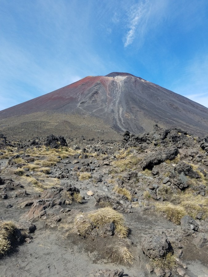
Mt. Nguaruhoe aka Mt. Doom aka my nemesis.
Tongariro National Park is the oldest National Park in New Zealand. The 19.4 km (12 mile) Tongariro Alpine Crossing hike is the best one-day hike in New Zealand and widely considered one of the top 10 one-day hikes in the world. Along with Mt. Nguaruhoe being used as Mt. Doom, other parts of the National Park were used as Mordor and parts of Middle Earth in the Lord of the Rings movies.

It begins
There are 3 active volcanoes within the immediate area of the crossing. The first and largest is Mt. Ruapehu.
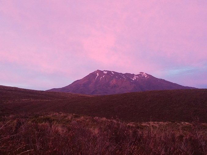
Mt. Ruapehu
At 2,797m (9,177 ft) Mt. Ruapehu is the largest volcano in New Zealand and the highest point on the North Island. The volcano last erupted in 2006 and then again in September of 2007. In May of last year, hikers were warned to stay out of a 2 km perimeter around the mountain, due to elevated risk of eruption. In recorded history, major eruptions have occured about every 50 years. In winter, it is the main ski mountain on the North Island. What appears to be snow in the picture are actually glaciers.
The smallest of the 3 volcanoes is Mt. Tongariro, standing 1,978 m (6,490 ft).
Mt. Tongariro in the background.
Mt. Tongariro last erupted on November 21, 2012. An eruption on August 6, 2012 at the Te Mãri Craters (part of Tongariro) sent blocks as big as 3 feet 3 inches up to 1.2 miles away from the vent. An ash cloud 3.8 miles high travelled 160 miles in 4 hours. In just 39 minutes after eruption, the cloud had expanded to 16 miles long and 9.3 miles wide.
That just leaves me and Frodo’s enemy, Mt. Ngauruhoe. Mt. Doom stands 2,291 meters tall (7,516 ft) and last erupted in 1975. In the 20th century, the volcano erupted 45 times.
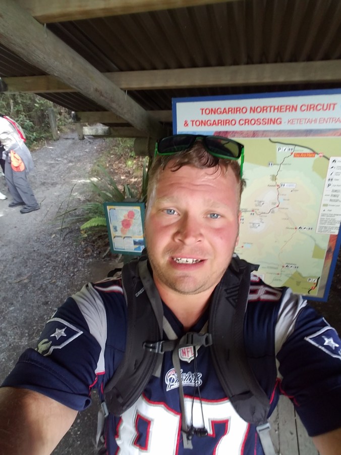
So, I started my hike just after 7 am. All the information I read said to bring plenty of food, water, rain gear, warm weather clothes and all the first aid and safety stuff you may need on a hike, as well as a map and compass. I took everything out of my backpack that wasn’t on the list, but was still carrying an extra 25 lbs on my back. I would have been fine with 3 liters of water, a sandwich, a couple protein bars and my camera in my day pack, but I followed instructions like a good boy.


At the 6km mark, I reached the base of Mt. Ngauruhoe. 7,516 feet up at a 45° slope. Why did I tell everyone I was going to climb Mt. Doom? Oh, well, I had no choice now. Our shuttle bus driver had told us not to climb without a helmet because rocks get dislodged by other climbers and sometimes people get hit in the head by the rocks hurtling down the mountain. I didn’t have a helmet. Most people didn’t have helmets. I only had to dodge one softball sized rock and it only would have hit me in the back of the leg.


Another kid at my hostel had done the crossing also, but started later than me. I passed him as I was just about down the mountain and he was just heading up. When he got back he told me that on his way down, a guy had fallen and had to be helicoptered off the mountain.
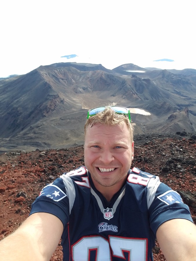
I left my pack at the bottom of the mountain, because there was no way I was making it up with it on. Much of the slope we climbed was composed of scree, which is volcanic rubble. Thankfully, there was one narrow strip of pretty solid rock going up a decent portion of the mountain because the scree was essentially like climbing a rocky, sand dune. It took just over an hour and a half to get to the top, but I made it!!!


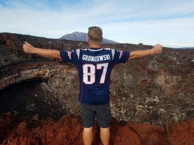
Reppin the champs and bringing the Gronk fiesta to the summit of Mt. Doom!
Going down the mountain was way more fun. It only took about 40 minutes to get down thanks to the scree. I fell on my ass a few times, but I basically jumped, slid, and “skied” my way down.
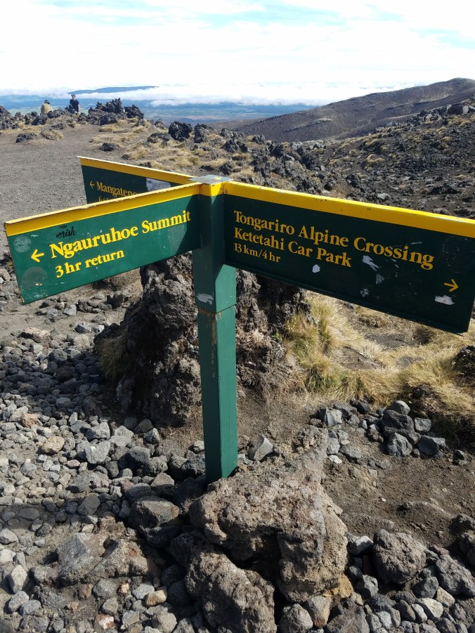
I left a piece of myself on that mountain yesterday. I’m pretty sure it was my quads. 😂. I had kind of hoped that someone would have stolen my pack or at least lightened my load, but everything was right where I had left it, tucked behind a rock about 10 meters up the summit track. When I got to the bottom, I was greeted by this sign reminding me how far I still had to go.
😭😔😲😢😴😖🤔😥
I celebrated my successful climb with about 20 minutes of Disney hits before realizing it was gonna take something with a little more energy than “The Circle of Life” to get me through the rest of the hike. The next couple hours of my walk were spent with a Spotify playlist called “Air Punch” and it was amazing.

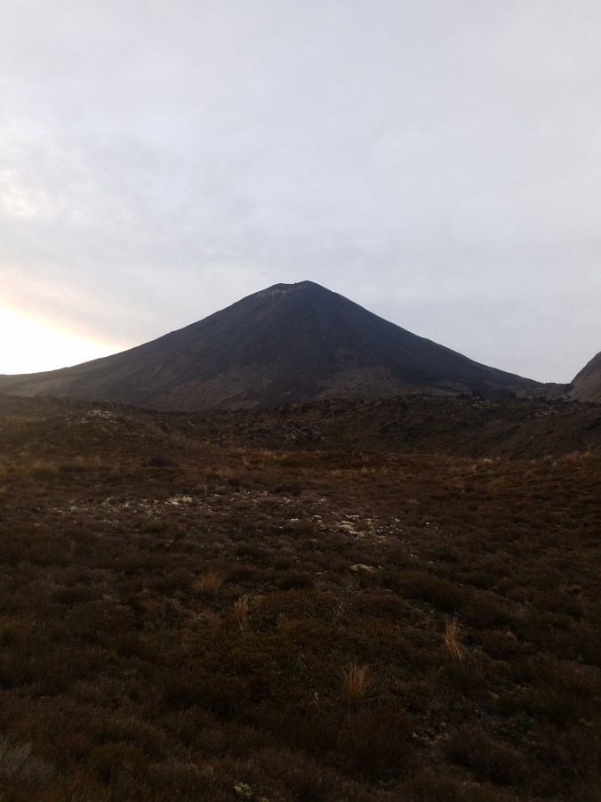
The next part of the walk was a nice flat stroll to the South Crater, where Mt. Doom continued to linger over me as though I had not just conquered it.


The leisurely stroll didn’t last long as it was time to ascend 1,886 meters (6,187 ft) to the Red Crater, which is part of Mt. Tongariro. This was a struggle. My legs were gone and my pack felt like it was full of bricks. At one point, I literally looked at my bracelet and thought, “Come on, Bear. Get me through this.” Kylah was my trainer for the Falmouth Road Race last year. She got me to about the half mile point before she gave up, but man did she push me hard for that half mile!! Love you, Peanut!! 😚


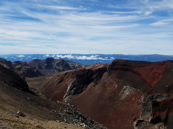
The Red Crater
I got to the top and had a great view overlooking the Red Crater, but just up another small climb was an even better view. The Emerald Lakes!!


From there, we descended down to the Blue Lake and then around and down the back side of Mt. Tongariro. It was easy sledding at this point. A nice gradual descent to the carpark. Hold on, what do you mean it’s still 10 km from the Blue Lake to the carpark? Ok, so a nice gradual 3 hour descent. Then came the stairs. I hate stairs!!! Give me paths, rocks, boulders……anything but stairs. Why are stairs such a nightmare when hiking?


Anyway, I started talking to a kid from Auckland and we walked at a pretty good pace for the last 6km and reached the carpark at 3:45. So the 12 mile hike and the summit climb combined took just over 8 1/2 hours.
Look how much fun I had!! I survived though!
I boarded the 4 o’clock shuttle back to the hostel and my legs hurt the rest of the night, not soreness but actual pain. I woke up sore today, but felt surprisingly good.
Today has been a rest day and my next stop is Waitomo to visit the Waitomo Glowworm Caves. Until next time!!!
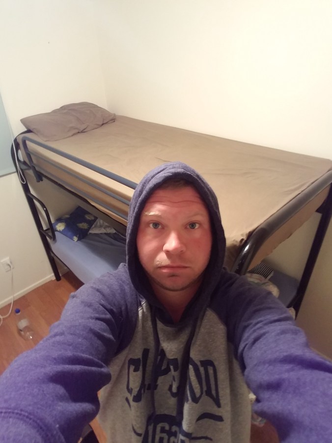
This is my walking to the bus in the rain at 2:45 am face.
